AYP Drone Use

The Drone and Model Aircraft Code
The Drone and Model Aircraft Code
The Drone and Model Aircraft Code
We follow the Civil Aviation Authorities Drone and Model Aircraft Code to develop our procedures and processes, to fly legally, responsibly and protect the privacy of the public.

Our Risk Management
The Drone and Model Aircraft Code
The Drone and Model Aircraft Code
Drone risk assessments help our operators to classify the risk of drone operations and identify mitigations. A key element is ensuring separation distances between drones and people, buildings, and other airspace users.
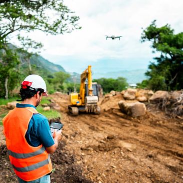
Drone Surveys
Drone Surveys
Drone Surveys
These surveys involve use of unmanned aerial vehicles (UAVs) equipped with cameras and sensors to capture aerial data for various applications like mapping, inspections, and data collection. These surveys offer a cost-effective and efficient alternative to traditional ground-based methods, especially for hard-to-reach area.

Dronedesk
Drone Surveys
Drone Surveys
We use Dronedesk which is a comprehensive drone operation management system and software, designed to streamline our planning, risk management, operations, and logging for our commercial drone operators.